Guide
How to Find Elevation on Google Maps on Your Mobile
The use of Google Maps has fundamentally changed not just how people get from one area to another but also how they find new places to go. Those who live in hilly areas can get a better sense of the elevation of the place they’re exploring by using Google Maps, which comes equipped with a wide range of capabilities. These features include options to see the topography and elevation. Google Maps makes it easy to find the elevation for most sites, which is useful whether you’re going on a trek or you’re just wondering about the heights of a certain place. This post will teach how to locate elevation on Google Maps on your mobile device by using the Google Maps app. So let’s get started:
Read Also: How to Change My Google Maps Address on Mobile
How to Find Elevation on Google Maps on Your Mobile
You may get the height above sea level of a certain area by utilizing the Google Maps application on your mobile device. Launch the Google Maps application that is stored on your mobile device in order to complete this task. Tap the “Search Here” box at the very top of the page to begin your search for a location within the app. Once you have the name of the location typed in, press the Enter key to proceed with your search.
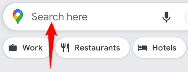
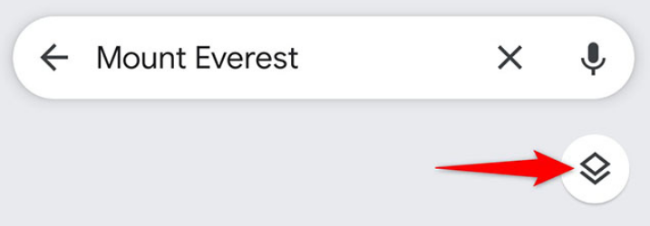
Once you have positioned yourself on the map, you can access the “Layers” option by tapping the button that appears to the right of the map.
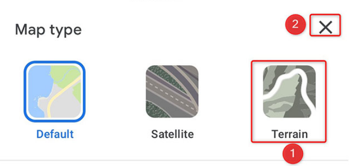
Choose “Terrain” from the portion of the menu labelled “Map Type” that displays when you click the drop-down arrow. After that, you need to select the “X” that is located in the top right corner of the screen.
The view of your map will now include the terrain profile as soon as it has been loaded. If you zoom in on the area of the map where you are currently standing, you will see that the elevation of the ground is indicated somewhere on the page.
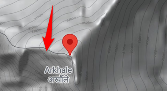
If you zoom in on the map just a little bit, you will be able to see the height numbers more clearly; however, if you zoom in too far, the elevation numbers will be obscured. You should now be able to use Google Maps to calculate the elevation of a specific location, using the information provided above.
FAQs
Does Google Earth show elevation?
You are able to design a path and view its elevation profile by using the tool referred to as the Elevation Profile. In addition, wherever you point your cursor on the map, Google Earth will reveal the elevation of that location. The current elevation of the cursor can be found in the lower right corner of the screen.
Can GPS find elevation?
Although though they are not officially recognized as pressure altitude sources, GPS receivers have the ability to calculate a GPS-derived altitude value for the receiver by triangulating the GPS satellite signals that they have received. This formula for triangulation is utilized at all times and offers the same level of accuracy regardless of the altitude.
Can my phone tell me my elevation?
The Compass app on your smartphone will display the precise coordinates of your location as well as your altitude if it is able to connect to a satellite and maintain a stable connection. Regrettably, Android does not come pre-installed with such an app of its own accord. The good news is that there are a number of third-party apps that let you view your current altitude.
What is elevation in navigation?
Height above or below a predetermined reference point is what we mean when we talk about a location’s elevation. This point of reference is most often a reference geoid, which is a mathematical model of the Earth’s sea level as an equipotential gravitational surface (for more information, see Geodetic datum and Vertical datum).
Does elevation mean depth?
The vertical distance above mean sea level is referred to as the elevation. Whereas depth refers to the distance below the surface of the water.


